Ultimate Whitewater in North Central Idaho
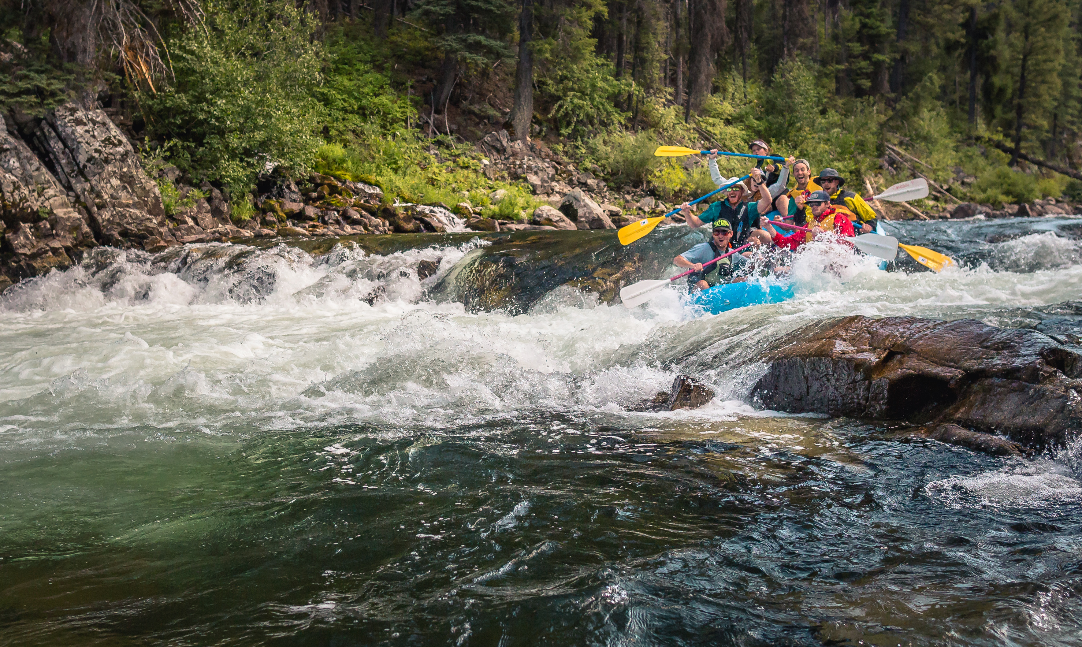
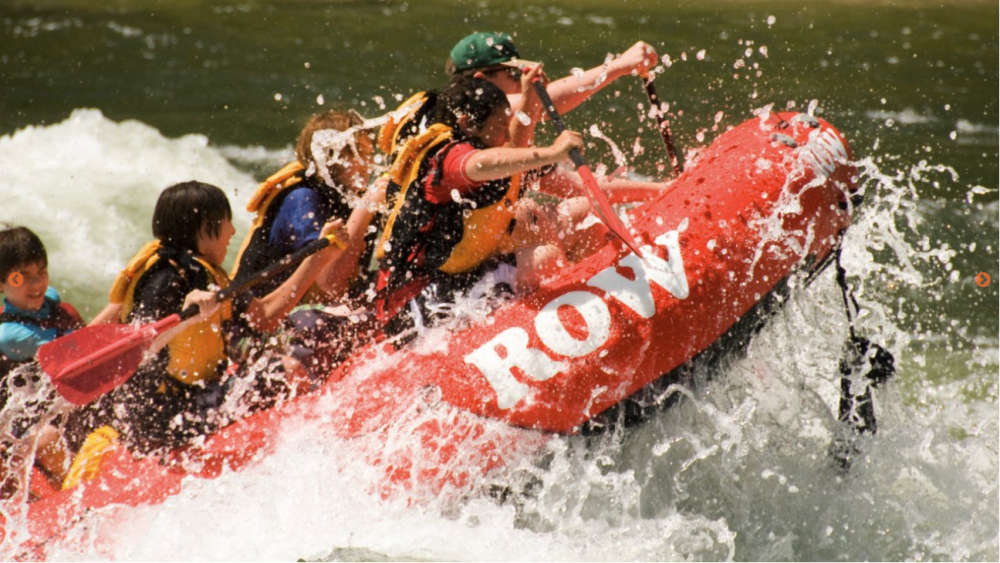
Idaho is one of the premiere whitewater rafting destinations in North America. The Salmon River is consistently in the top 5 on many lists. Planetware named FIVE of our rivers the "Best Places for Whitewater Rafting in Idaho". Plan an adventure to experience North Central Idaho whitewater. You'll find everything from family-friend mild to adrenaline wild!
Lochsa River
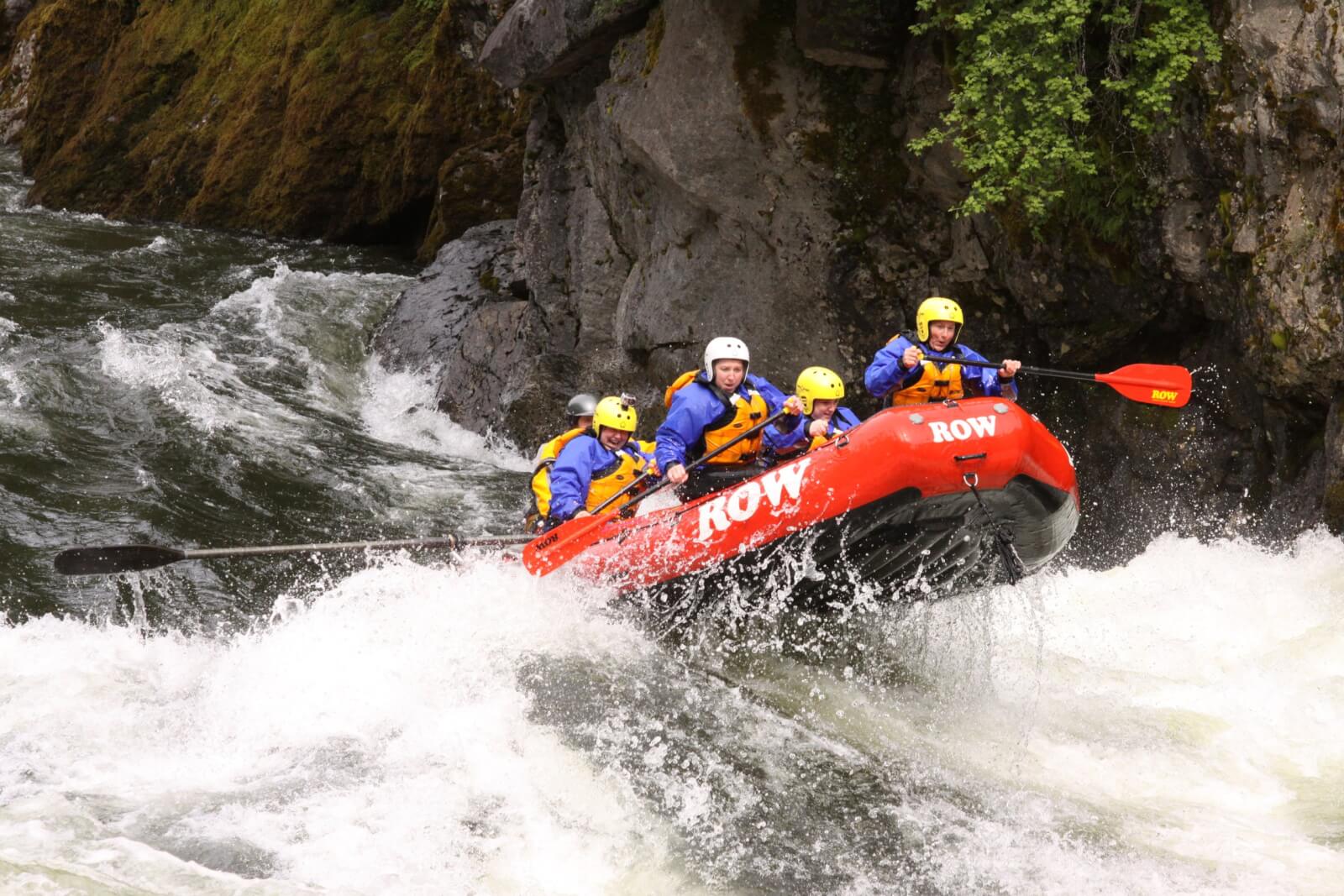
The Lochsa River parallels scenic Highway 12 northeast of Lowell. The word means "rough water" in the language of the Nez Perce. From its headwaters in the Bitterroot Mountains to its confluence with the Selway and Clearwater rivers, the Lochsa pounds through more than 40 major rapids. With names like The Grim Reaper, Bloody Mary, Ten Pin Alley, and Mile Long, your heart will be pounding before you reach the rapids. The season begins in the spring and can run into July and August. Highway 12 is barely visible from the river which is bordered by a cedar forest. Most outfitters use paddle rafts on the Lochsa to make it a fun participatory trip. River runners camp in nearby meadows or stay in area lodges. One, two, and three-day trips are $80-$350 per person. River Stats: Difficulty: IV- to IV+; Trip Length: 30 mi.; Put in: White Pine or Nine Mile; Take Out: Split Creek or Knife Edge
Clearwater River
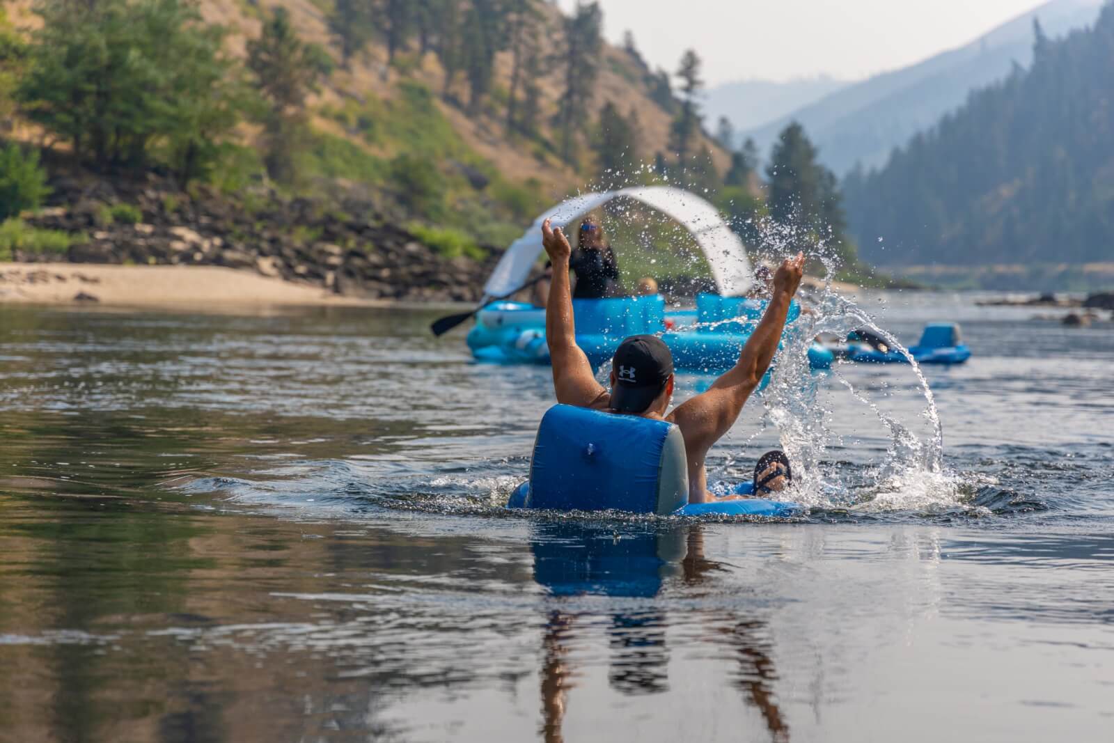
Take a day float from Kooskia to Orofino or from Orofino to the confluence of the Snake River. The Clearwater River provides an easy float along scenic Highway 12. Wildlife viewing is good here and the river is very easy to access. Join outfitters and local historians to float where the Corps of Discovery floated, or grab an inner tube or raft and float sections on your own. The popular local float is Kamiah (5 Mile ramp); 5 Mile Ramp (Zan’s Ramp); Zan’s ramp (Orofino City Park). River Stats: Difficulty: I to II; Trip Length: 23 mi.; Put in: White Pine or Nine Mile; Take Out: Split Creek or Knife Edge
Middle Fork Clearwater River
The Lochsa and the Selway come together at Lowell to form the Middle Fork of the Clearwater. Along Highway 12 below Lowell is a pleasant summer Class II canoe float. During spring runoff, the river could be dangerous for canoes because of high river flows. The riverbed is wide at this point. The beginning of the float begins in lush cedar forests but gradually drier vegetation becomes more pronounced towards the end. While in the area, we recommend driving up the Selway for a look at the falls. You could consider a float down the lower section of the Selway. This would make an excellent family canoe trip, first time raft or fishing trip. In the fall, this is premium steelhead country. River Stats: Difficulty: II- to II+; Trip Length: 23 mi.; Put in: Lowell; Take Out: Kooskia
South Fork Clearwater River
Flowing from Elk City to Kooskia Idaho surrounded by national forest, the 62-mile long river in joins with the Middle Fork Clearwater River. The white water view is enjoyable in this part of the country, thanks to the verdant mountain valley backdrop. The inspiring peaks of the Selway-Bitterroot Wilderness surround the river much of the way. This is premium fishing country; expect trout, salmon and steelhead. River Stats: Difficulty: IV-V; Trip Length: 62 mi.
Main Salmon River
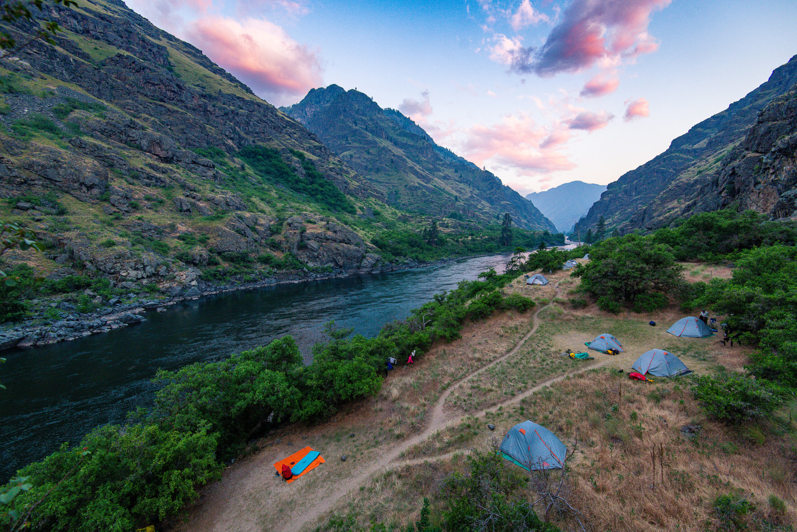
The "River of No Return" is an ideal family section with mainly class III rapids. It is considered a wilderness section but has ranches located along the route of the Main Salmon which allow people to choose lodge-to-lodge stays. Outfitter and personal jet boat/float trips are highly regulated by the Forest Service to eliminate over populating the river system. Most people take six days to run the 80 roadless miles to Vinegar Creek. Most of the canyon is densely forested with ponderosa pine, Douglas fir and some grand fir. There is good hiking up side creeks and good fishing near their confluences. Attractions not to be missed include Barth Hot Springs and the old Painter Mine at river mile 274. And check out Buckskin Bill’s old homestead a mile below Painter Mine. Buckskin Bill (real name Sylvan Hart) died in 1980. He was known as "the last of the mountain men." He built his own house, raised his own food, and made his own guns and tools. River Stats: Difficulty: III to IV; Trip Length: 85 mi.; Put in: Corn Creek; Take Out: Vinegar Creek
Middle Fork Salmon River
The Middle Fork of the Salmon flows through the Frank Church - River of No Return Wilderness area, the largest forest wilderness in the lower 48 states. The Middle Fork is the historical origin of wilderness whitewater rafting trips (most last five nights and six days) and the most popular long river trip in Idaho. It combines a beautiful wilderness setting with 100 frequent rapids over 100 miles, hot springs, reserved forest campsites, limited access and party size, and no jet boats allowed. In 1968, the Middle Fork was protected as a Wild River, becoming part of the National Wild and Scenic Rivers System. Kayakers with intermediate-level skills and a good roll should have no difficulty on any part of the river at any water level. River Stats: Difficulty: III to IV; Trip Length: 100 mi.; Put in: Dagger Falls; Take Out: Main Salmon
Salmon River Above Riggins
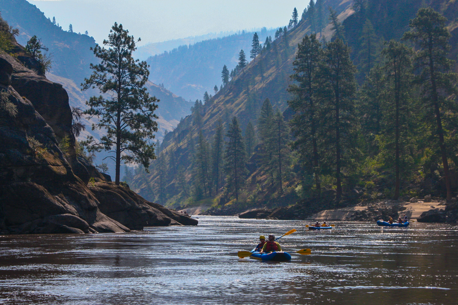
Massive ponderosa pine and vertical granite slabs adorn the scenic drive up the Salmon above Riggins. During runoff, several huge rapids - Vinegar, Ruby and Lake Creek - always should be scouted. The river can be unpredictable at high-water flows and requires an experienced outfitter to navigate. In mid-June, things mellow out and the river turns into a playground. The rapids become more drop-pool in nature. Good kayak play spots emerge, especially around the Wind River Bridge, with long flat spots in between. This is excellent Class III canoe, raft, and dory country. Fishing can be excellent with fall and winter being the time to stalk the elusive sea-run rainbow trout, otherwise known as steelhead. Camping is fantastic. River Stats: Difficulty: III- to IV; Trip Length: 28 mi.; Put in: Vinegar Creek or Carey Creek; Take Out: Spring Bar, Riggins, Lucile
Salmon River Lower Gorge
The Lower Salmon Canyon is probably Idaho’s most underrated long river trip. It is particularly good late in the summer when other rivers have too little volume to provide exciting rapids. This offers a rare opportunity to do a spur-of-the-moment, three-to five-day trip on the river since permits are readily available. There’s not a river in the world that has better camping than there is on the lower Salmon’s big, white beaches. Most people take four to five days to do the trip. River Stats: Difficulty: III- to IV; Trip Length: 80 mi.; Put in: Hammer Creek, Rock Creek; Take Out: Eagle Creek, Heller Bar
Salmon River Below Riggins
Riggins to Lucille is a maximum-fun Class III run. It features lots of "big-water" rapids, yet is a relatively safe run. The adjacent road (good for scouting), deep water and clear channels are comforting to novices. This "premier" 10-mile stretch, during the mid-summer months, offers the best day trip whitewater in Idaho! Swimming, playing on beaches, and bouncing a raft through fun class III rapids will surely put a smile on your face! Rapids like "Time Zone, Tight Squeeze" and "Fiddle Creek" provide excitement for all types of boaters. From guided to private rafting, this stretch is the most popular in Idaho at this time of year. From Riggins to Lucille there are ramps and access points along US Highway 95. Commercial outfitters are available for walk-in rafters in Riggins. River Stats: Difficulty: III- to IV-; Trip Length: 10 mi.; Put in: Riggins and Shorts Bar; Take Out: Lucile
Selway River
The Selway River is a Nationally designated Wild and Scenic River flowing through the Selway-Bitterroot Wilderness Area. There are a number of great class II and III rapids as the river flows through lush stands of old-growth forest with great campsites along the way. The Race Creek take-out is just upstream of the Meadow Creek confluence where Forest Road 223 comes up river from Highway 12 at Lowell. In another mile the Selway cascades through Selway Falls, a boiling cauldron of holes and sieves that is best enjoyed from the overlook along the road as you start your drive home. River Stats: Difficulty: III - IV/V; Trip Length: 47 mi.; Put in: Paradise Boat Launch, Moose Creek; Take Out: Race Creek
Snake River - Hells Canyon
Hells Canyon offers scenic vistas that rival any on the continent. World-class whitewater boating. Spectacular mountain peaks. Vast reaches of remote wilderness for hiking or horseback riding. Diverse and abundant wildlife. Artifacts from prehistoric tribes and rustic remains of early miners and settlers. Hells Canyon National Recreation Area truly offers something for everyone, and much to remember.
Guided jet boat and rafting tours leave from Lewiston and White Bird (seasonally) daily. Hells Canyon, though a nationally famous run, has fairly easy whitewater. It is a good long trip in primitive surroundings for novice to intermediate boaters. There are two exceptions to that overall description - Wild Sheep and Granite rapids. Both are Class IV, but easily portable. Hells Canyon is also a good run for dories and inflatable kayaks, in the hands of experienced paddlers.
The river in the lower half of the canyon below the Pittsburgh Landing rafting take-out, flattens out considerably. Strong upstream breezes are common on summer afternoons and can make rowing a slow, strenuous process. The lower part of the canyon is also a popular weekend playground for jet boaters.
Spring rains and snow-melt bring the canyon’s sparse vegetation to life from mid-April to mid-June. But the middle of the summer, you can expect to have very hot, very dry weather and terrific swimming. Hells Canyon boasts excellent fishing for small-mouth bass and sturgeon.
The Hells Canyon National Recreation Area, managed by the Wallowa-Whitman National Forest, hugs the borders of northeastern Oregon and western Idaho. This national showcase holds 652,488 acres of beauty and adventure, where you can let your senses run as wild as the landscape.
River Stats: Difficulty: III to IV; Trip Length: 81 mi.; Put in: Hells Canyon Dam; Take Out: Pittsburgh Landing or Heller Bar